See the Conversation Progress
Keep Up-to-Date with the Conversation
As the review of the Surrey Hills AONB boundary progresses over the period November 2021 - June 2022, your input will be combined with information provided by others with similar (or different) interests and shared through the interactive Story Map, which can be accessed below.
Evidence Gathering Update (early Feb.2022)
As noted on the Share page, the Evidence Gathering phase closed at the end of January 2022, with well over 400 submissions received in the last 24 hours. Given the large response we had in the last few days of this stage of the boundary review process, there is a slight delay in uploading and moderating all of the submissions. Our aim is to have this complete for online submissions by Monday 7th February, and for e-mail / paper submissions shortly after that - please bear with us while we work through the submissions in order to add them to the Story Map.
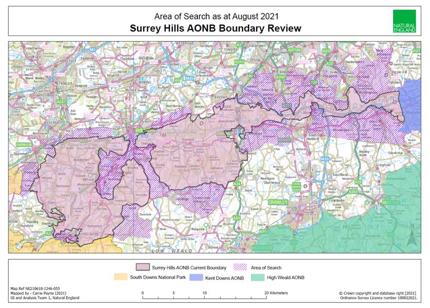
Surrey Hills Boundary Review Story Map
This interactive, map-based application will provide information on each of the Evaluation Areas along with background layers of relevant landscape data. The Story Map will also be updated regularly with information gathered from survey participants, so you can also keep track of how other individuals and interest groups perceive the Surrey Hills and surrounding landscapes.
To open the interactive map in a separate browser tab, click on this Story Map link or click on the image below.